Press "Enter" to skip to content

Category: Tactile Maps

Tactile maps turn visual spaces into something you can explore by touch: street layouts, building floor plans, museum galleries, transit stations. Here you will find what tactile maps are, how they are made, from traditional raised-line graphics to 3D printed maps, and where they make independent travel possible.

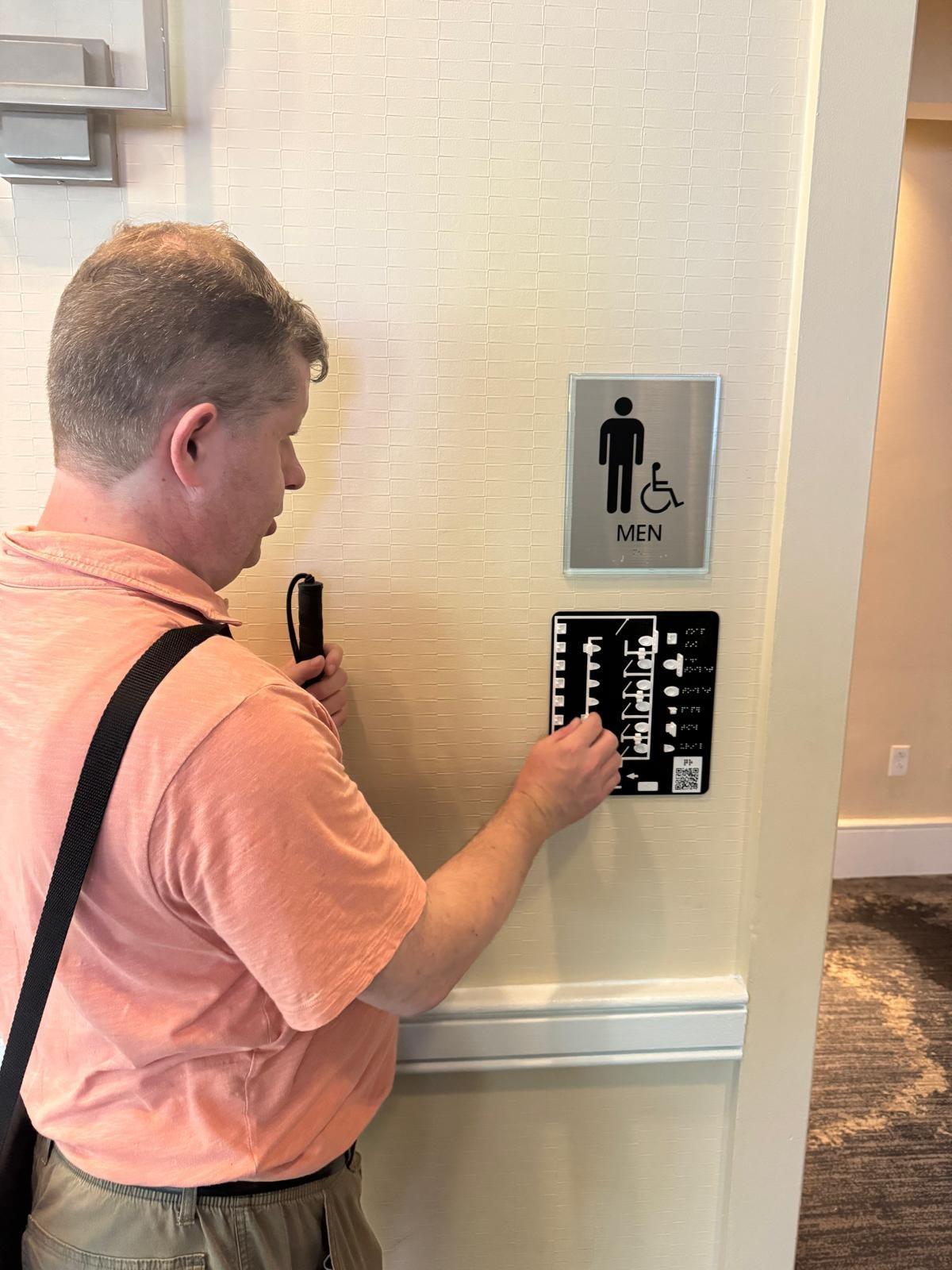
Accessible tactile 3D printed restroom maps for blind visitors

If you are blind, when you visit a restroom by default you will end up touching many more things than sighted people to find the same facilities. Wouldn’t it be great to minimize contact with things you wouldn’t need to touch in the first place?

This is why I invented the accessible tactile 3D printed restroom maps.

A tactile restroom map is a 3D-printed miniature replica of a restroom’s layout, mounted beside the ADA sign, that blind visitors can feel before entering.

When a blind person visits a restroom, before they enter they can quickly examine a map of the exact layout of the restroom so they can go exactly where they want to without having to explore and accidentally touch more than necessary.

accessible tactile restroom map including a sink, toilets, urinals, paper holders, hand dryer and doors.

4 Comments

When 3D printing is preferrable to 2D tactile graphics

When supplying visual materials with braille books for the most part the use of tactile graphics is sufficient. However, there are many instances when providing 3D printed objects can enhance the understanding of the material. Even the Tactile Graphics Guidelines Mention 3-dimensional objects in the first sentence of the document: “Tactile graphics, in combination with 3-dimensional models, need to be introduced early in the process of learning braille.” Throughout this document 3-dimensional models are mentioned many times.

However, when it comes to practical implementation, rare are the books which are supplied with 3D objects. When I talked with many teachers of the visually impaired and with braille transcribers, their response was that while they are aware of the possibility of using 3D objects, but there is very little information on how to source these and what it really takes to get it produced.

In this post I will talk about what makes a good candidate for 3D printing and what is better supplied in 2D, or not at all. I will also look at the production process to help make the decision if 3D representation is indeed the right option for a particular object.
Leave a Comment

Tactile Maps and Braille: Balancing Accessibility and Practicality

Creating accessible maps for individuals with visual impairments is a complex process. When designing tactile maps, we need to carefully consider how to best integrate braille to convey information effectively without sacrificing practicality and efficiency. This post explores the challenges and solutions involved in using braille on tactile maps, drawing from our design experience.

Leave a Comment

The advantages of 3D tactile maps

Tactile maps are, by design, three-dimensional, as they use raised surfaces to make a two-dimensional map touchable. However, traditional tactile maps elevate features just enough for them to be discernible by touch, while 3D maps go further by utilizing height and depth to convey richer, more intuitive information. This makes >3D tactile maps more effective and accessible in many contexts.

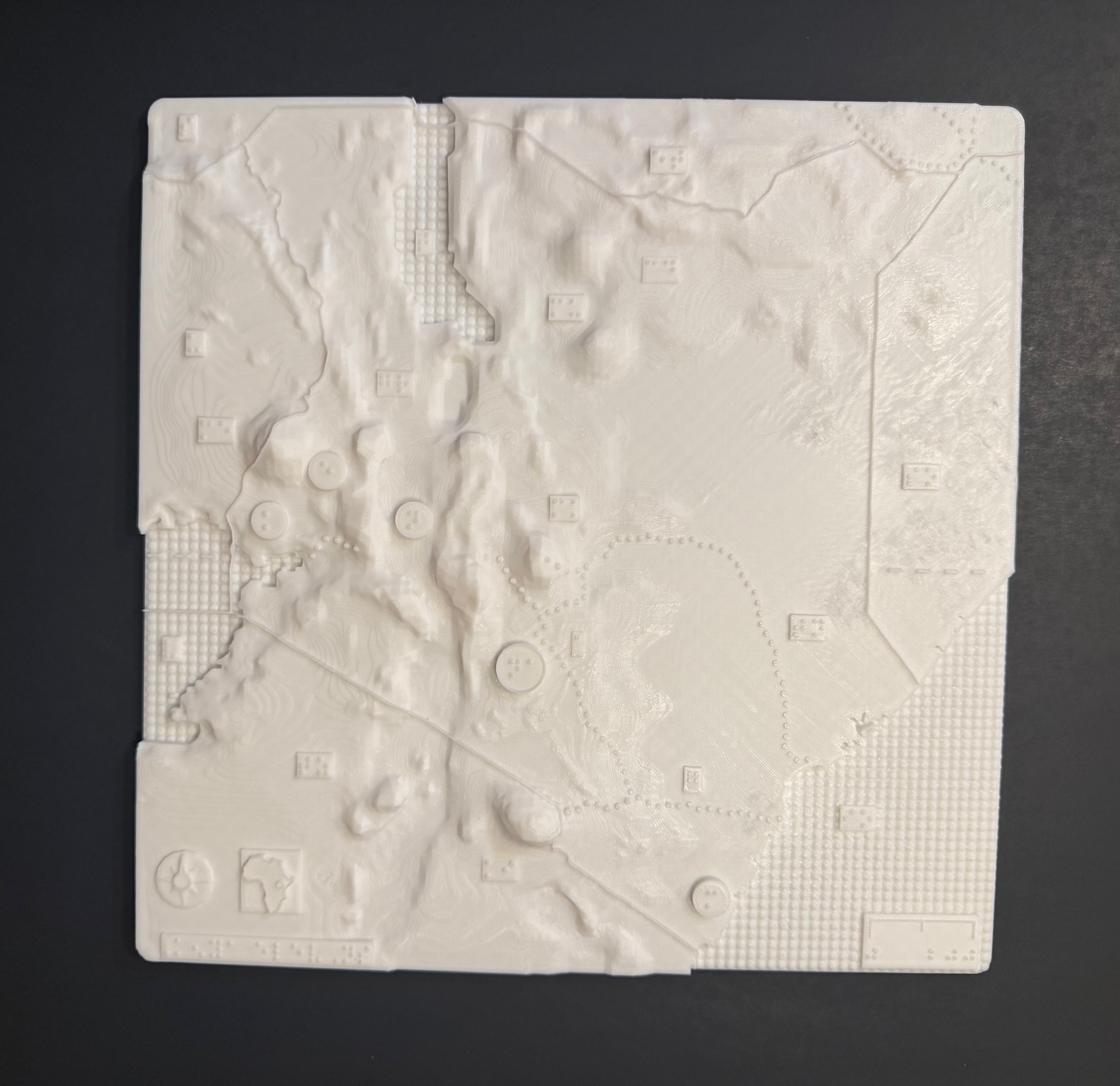
Kenya elevations 3d tactile map

The above 3-D map shows the elevations of Kenya with braille labels, made in collaboration with the Clovernook Center for the Blind & Visually Impaired

Leave a Comment

Exploring the World with Touch Mapper: 3D Printing Tactile Maps for the Visually Impaired

I am always searching for innovative solutions to enhance the independence of visually impaired individuals. One such solution that has captured my attention many years ago was Touch Mapper, a service that allows the printing of local maps based on addresses. These tactile maps, designed for blind and visually impaired people, show roads, buildings, and bodies of water, with data sourced from OpenStreetMap. With my new 3D printer, it was finally time to put it to a test.

2 Comments